MMO Range Finder

Precision for your Mitigation

Features

Marine Mammal Observers mitigate for the potential impact of sound exposure on marine fauna during geophysical surveys, naval active-sonar exercises, UXO clearance or civil engineering projects.
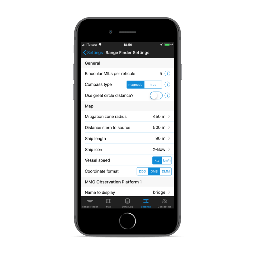
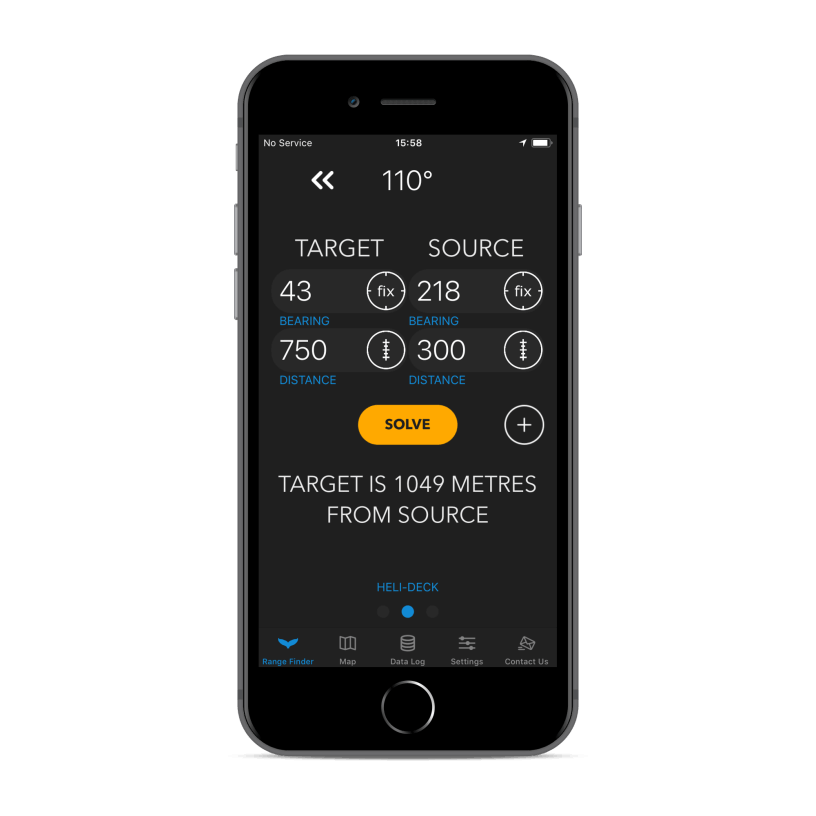
MMO Range Finder assists the observer making mitigation decisions by calculating the distance from the animal to the source of acoustic interference using a trigonometric cosine function as well as converting binocular reticules to horizontal distance depending on the observer height above sea level. 
Mobirise Website Builder
Distance to Source

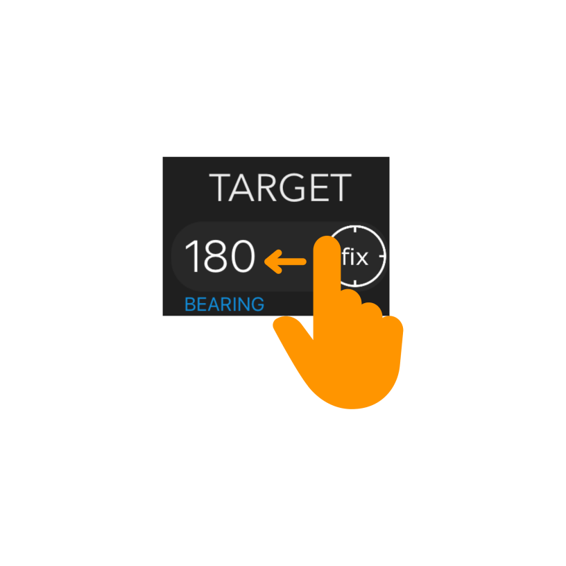
Accurately estimate the distance of the animal to the source to make informed mitigation decisions
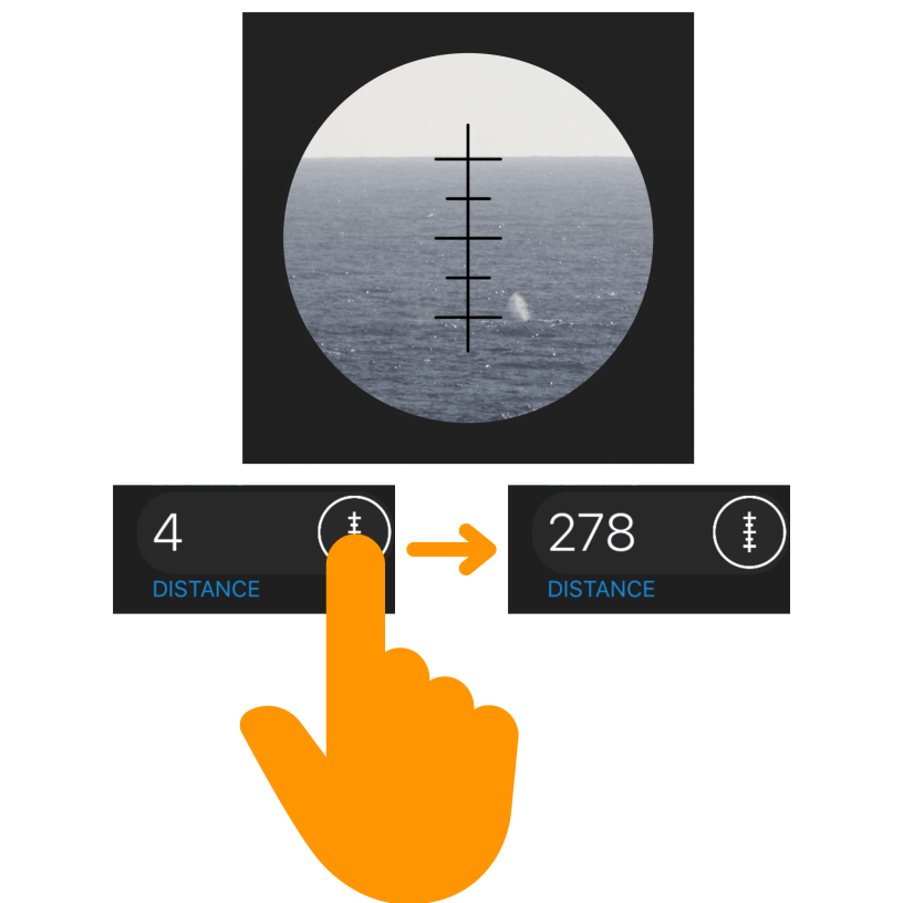
Mobirise Website Builder
Reticule Conversion

Instantly convert binocular reticule readings to horizontal distance based on observer height
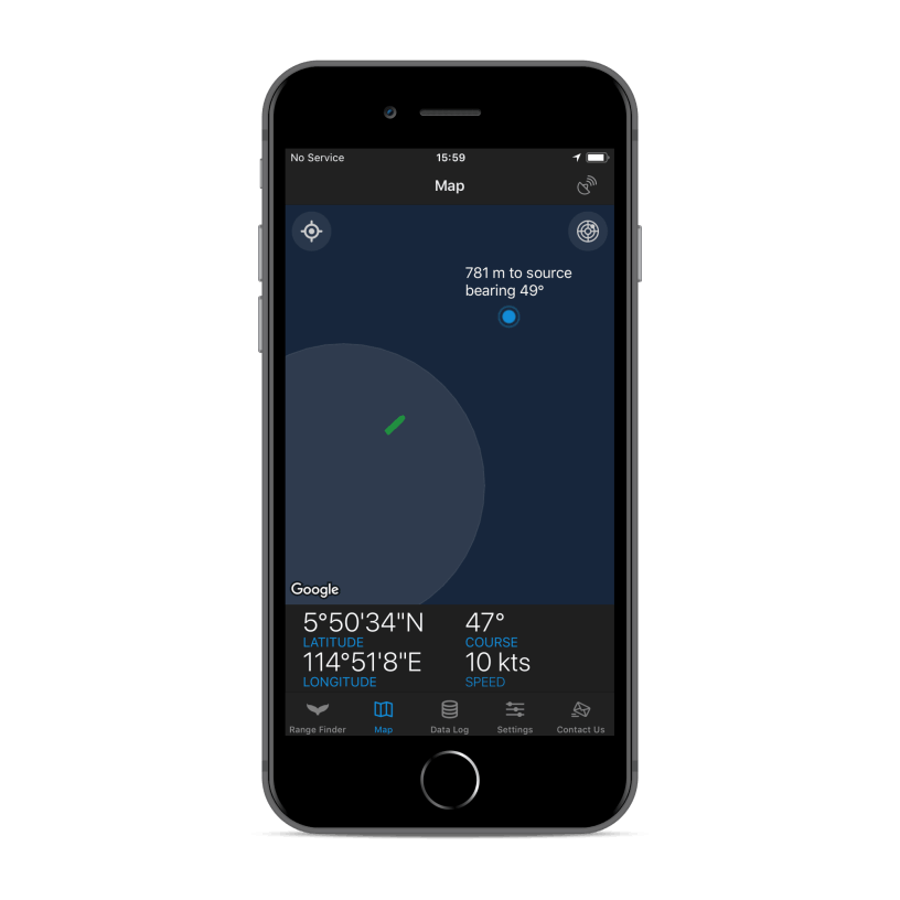
Mobirise Website Builder
Spatial Awareness

Review the observation in the map tool which includes dynamic mitigation zones.

Mobirise Website Builder
Gesture-enabled

Swipe left on text fields to clear data in that field. Shake device to clear all fields

Mobirise Website Builder
Have it your Way

Fully customizable (iOS version). Change observer eye-heights, MILs per reticule or survey vessel icon

Mobirise Website Builder
Data Log

Capture data and export later for reporting (iOS version); including observer, source and animal coordinates, COG/SOG and more

Download the MMO Range Finder

Mobirise Website Builder

Field Tested since 2017

Mobirise Website Builder

Download the User Manual

The MMO Range-Finder application should be used as a reference tool and is only as precise as the user’s ability to use range-finding tools at sea. Any mitigating actions taken are the responsibility of the user. If in use, the compass and GPS location should be verified often against calibrated instruments commonly available on the bridge of a ship.

No Code Website Builder